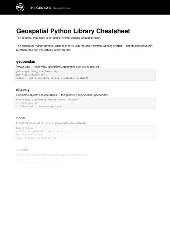
Geospatial Python Library Cheatsheet

Look inside

Geospatial Python Library Cheatsheet

$49

Syntax guide for Geopandas, Rasterio, Shapely, PyProj.

For: Data Scientists
Format: Instant digital download

Before you buy

1 file · 65 KB · PDF

See the real first page before you pay.

See exactly what you get

Geospatial Python Library Cheatsheet is a ready-to-use technical resource for professionals who need to get the technical work right the first time – without starting from a blank page.

Syntax guide for Geopandas, Rasterio, Shapely, PyProj. Built from delivery experience on large-scale GIS and smart-city programmes, so it reflects how this work is actually done rather than how it is described in a textbook.

What you get

  • Syntax guide for Geopandas
  • Rasterio
  • Shapely
  • PyProj
  • Instant digital download – use it on client work immediately
  • Editable format you can rebrand for your own organisation

Who this is for

  • Data Scientists

Why it matters

Most GIS teams lose more time to missing structure than to missing software. A documented, repeatable artefact removes the argument, shortens review cycles, and gives everyone the same reference point – which is exactly where spatial projects usually break down.


Need this tailored to your organisation?

If you would like this adapted to your own standards, data model, or delivery programme, book a consultation call and we will work through it directly. You can also review the advisory services on offer or explore the training programmes.

Questions before buying? Email Support@thegeolab.digital.

#TheGeoLab #GIS #Geospatial #SpatialAnalysis #Python

Before you buy

Exactly what you get

Read out of the files themselves, not written for this page.

  1. Geospatial Python Library Cheatsheet (PDF)PDF65 KB3 pages
    First page of Geospatial Python Library Cheatsheet (PDF)
    Real first page, shortened.
Add to cart $49

Delivered as an instant download after payment. Files are yours to keep and to use inside your organisation.